While my first day at Mount Rainier on Skyline Trail was beautiful in many ways, the crowds and the haziness over the skyline was a less than ideal combination. So, I was super motivated to have a more successful day two – enough to get up in the dark at 4:30am to drive across the park to the Sunrise region.
Mt. Fremont Lookout Trail
The Mt. Fremont Fire Lookout is a historic observation tower sitting at the end of an exposed ridge, overlooking numerous mountain peaks with the massive Rainier peak to the left. It’s about a 6 mile out-and-back hike with 1100ft of elevation. This is a popular lookout point to watch the sunrise from, so many people will hike out in the dark to secure their spot at the lookout to witness it. I did consider it, but with the extreme haziness that Washington was experiencing from the fires, I decided it may not be worthwhile and that an early post-sunrise hike at 6am would make me just as happy.
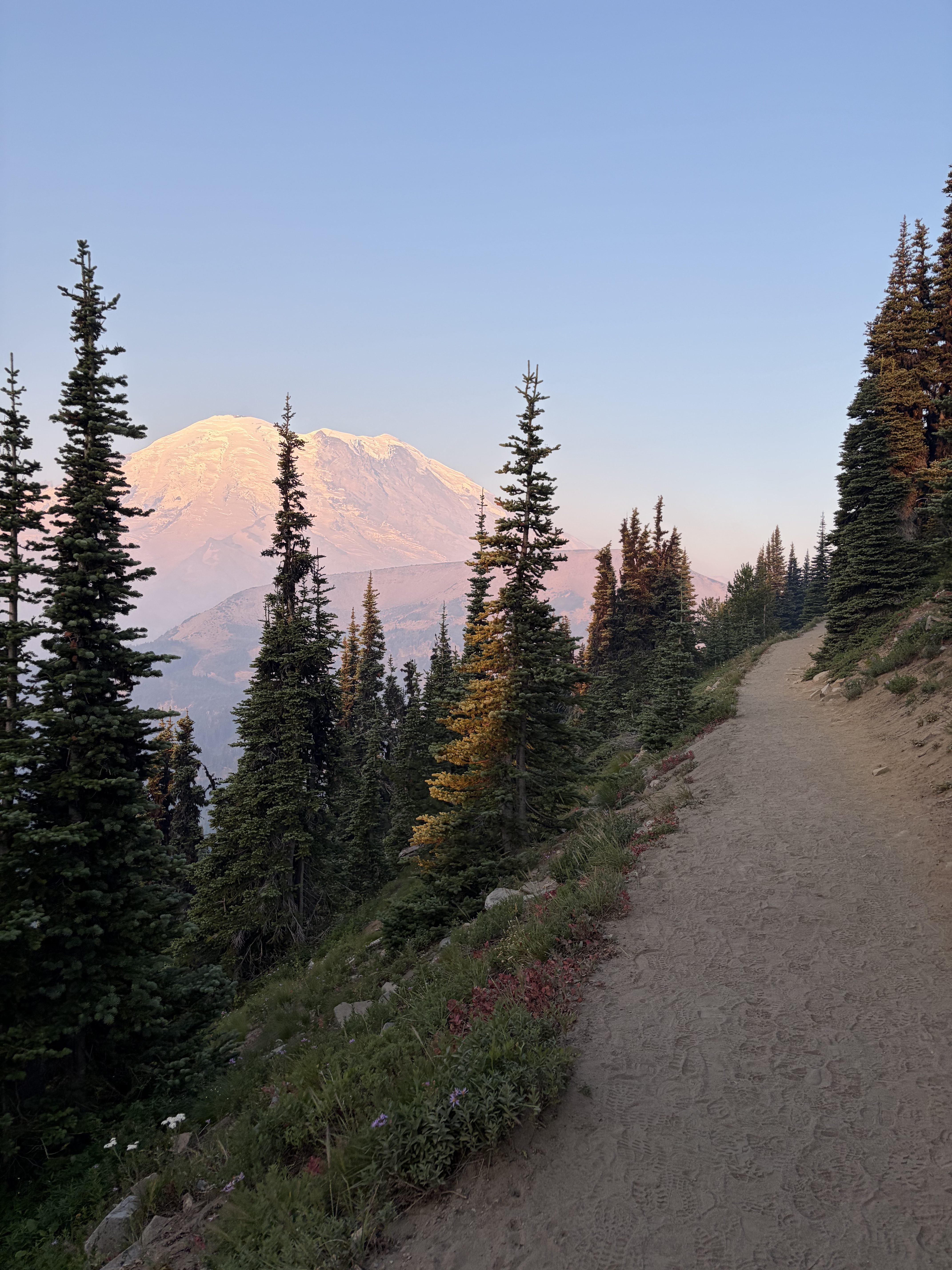
As I arrived at the Fremont Lookout trailhead, the sun had just finished rising. The sky was still holding onto the orange hues of the sunrise as I started the hike, creating a pink glow reflecting off of Mount Rainier. The immediate views of this hike were stunning with the mountain peaking above the trees. I passed only a few other people in my first mile or so, creating a much more peaceful and secluded feeling than the day before. I started passing a handful more early risers on their way down from the lookout as I got closer.
To my surprise and excitement, when I got to the lookout, there was only one other group there and they headed out shortly after I arrived. This was definitely the upside of doing the hike at 6am – I missed the big sunrise crowd, but I still beat the general morning groups. I wandered around the ridgeline, walking up the lookout tower stairs. It truly felt like being on top of the world, with a seemingly neverending view of mountain peaks. I took my time exploring, and found a nice rock to eat my trail mix – I made friends with a chipmunk, who was practically climbing on me while I sat there. They are definitely used to being fed because the little guy looked like he was expecting a snack.
After hanging out at the top for a while, the wind started to pick up and it got pretty chilly, so I started the descent back down the trail. I got back to my car around 9:30am, and made a fresh peanut butter and jelly sandwich while I debated what my next move would be. I had no service in the parking lot, so I drove a few minutes to a spot off the main road where I had seen some cell service pop up when I drove through earlier.
Decisions, Decisions
I had a couple of dilemmas I was working through at this point:
- I realized I was very low on gas, and had no idea where the closest gas station was. The park is massive, so you need to be mindful of how far you’re driving within it and how much of your tank you need to conserve to make it to a gas station after you drive out. Add on the extra variables of a rental Jeep Wrangler that was a gas guzzler, and limited cell service that made it difficult to even map myself to a gas station, I was cutting it closer than I would have liked.
- I was supposed to go to North Cascades, which is about a four hour drive from Mount Rainier. I had my campsite booked and my hikes planned. However, I would be heading closer to the fires up north and thus to worse air quality. So my question was “Will it be worth it?” North Cascades is stunning, and I was afraid that if I did drive all the way up there, I would be met with no visibility. I had planned this trip meticulously, but I knew that if I couldn’t see the incredible views that North Cascades is known for, I would feel unfulfilled and need to come back again.
First things first, I knew I had to head out of the park to get gas. The closest gas station was about 45 minutes away, so I mapped myself out of the park and hoped I could navigate if Apple Maps disappeared when I lost service after leaving this one sacred service spot.
After a wonderfully uneventful drive out, I arrived at a very small and remote gas station next to a tiny general store and filled up my tank. Thankfully, I had cell service here, so I pulled into a parking spot to finish deciding whether I was going to commit to North Cascades or pivot. Thankfully, Washington has no shortage of beautiful nature and national parks, so my backup option was to head southeast to Olympic National Park. After checking the North Cascades visitor center camera on the national park website and seeing nothing but a blanket of fog, I made the difficult call to cancel my highly sought after campsite reservations and switch gears.
I did some quick research to find a first-come, first-serve campground at Olympic National Park along with a few hikes that would be nearby to have a rough plan, and then headed out.
Olympic National Park
A few hours later, I rolled into Heart O’ The Hills Campground and quickly found an open campsite (thank goodness). I kept forgetting what the campground was called, and all my mind kept going to was The Hills Have Eyes – I’ve never seen the movie, but I know it isn’t great to think your campsite is named after it. After completing registration, I popped up my tent, changed into sweatpants, and made myself some tea in the kettle along with more rice and chicken on my camp stove.
After dinner, I hung out in my tent, and debated how early I would head out for my hike in the morning. I had seen signs about recent cougar sightings in the area, so I was a little apprehensive about going out too early and being too isolated. I had my bear spray but I had no interest in putting myself in a situation to test it.


Leave a Reply